Silhouette
An Island of Legend, Myth and Tropical Beauty
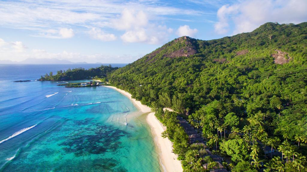
At 20 square kilometres in size, Silhouette is the third-largest Seychelles island, located 20 km (12.5 miles) off the western coast of Mahé, near to North Island. Although it is relatively close to the main island, Silhouette is the most undeveloped and most remote of the Seychelles' inhabited islands.
The forests on the high peaks of Mont Dauban (740 metres - 2,427 ft) are often shrouded in clouds, so it is sometimes not possible to look across to Mahé. These slopes are also home to the endemic, carnivorous pitcher plants, who owe their name to the island's second-highest mountain, the Mont Pot à Eau (620 metres - 2,034 ft - literally "Water Pot Mountain"). Countless bats hang head-first from the island's treetops during the day, before they become active in the evening, and gorge on ripe breadfruit and mangoes.
Although it belongs to the inner granite islands, Silhouette is actually made of volcanic syenite, which allegedly came about 63 million years ago following a massive eruption. This makes Silhouette much younger than Mahé, which is estimated to be about 650 million years old.

The crossing from Mahé/Bel Ombre takes about thirty minutes, or there is a fifteen-minute helicopter flight that guests can take too. La Passe is Silhouette's only port, and many of the island's 150 residents live near to this point. The island's other settlement is Grand Barbe.
Silhouette takes its name from Finance Minister Étienne de Silhouette, whom the French named the island after in 1771. The French were, from this point on, closely intertwined with the history of the island, especially the Dauban family, who gradually acquired the whole island, clearing the forest to cultivate cinnamon, vanilla, coffee, and especially coconuts. Up to a thousand people found work here during this time. Amidst the plantation is the mausoleum of the Dauban family, which gives you a certain indication of the family's great wealth and prestige. The old planters house in La Passe was renovated, and the stylish colonial mansion now serves as one of the seven restaurants of the island's villa hotels, offering Creole cuisine to island guests.

In 1983, the island was taken over by the state, and nowadays belongs to the Seychelles Island Development Company. Much longer ago, the island was used as a sailing base by Arabic sailors, as can be seen from the remains of some graves in Anse Lascars.
The interior region of Silhouette is a national park, with some of the richest biodiversity in the entire Indian Ocean according to ecologists. Hundreds of endemic birds, reptiles, and plants call the island home. In one of the island's own breeding stations, two species of turtle which were once considered extinct were re-discovered in 1995, researched, and released. The island should be maintained as a living museum of sorts, with many native plant and animal species being endangered. With 93% of the island's land mass under protection since 2010, it is unlikely that anything will change anytime soon. The island has no roads or cars, with just a few footpaths and electric carts belonging to the Hilton Seychelles Labriz Resort and Spa. The hotel was built in 2006, and offers a total of 100 rooms to guests. Despite the luxury of the resort, the island itself might seem more suited to a pirate adventure, as there are many stories of legendary pirate treasure on the island, although none has ever been found.
Silhouette offers many attractive walking trails where you can explore nature thoroughly. The old island footpaths, which contain no motorised vehicles, are ideal for these hikes. The starting point is always La Passe. One such hike, to Grand Barbe, is a four-hour trek, but definitely rewarding! The path is mostly in the shade of the dense forest, so the temperature is never too hot during the day, Nevertheless, we recommend starting early and walking with a guide. Here and there, you will meet forks in the path that may not be as easy to spot on the way back. Once across the island, follow the main path to the second main site on the island, located in the south-west coast settlement, once the place on the island where copra was produced. On the way, there are sandalwood trees, orchids, and endemic pitcher plants to see, while the path rises up to around 500 metres above sea level too (1,640 ft).
The gorgeous Anse Mondon is another attractive destination that can be hiked to from La Passe in two hours. The bay is located on the north side of Silhouette, and the road that leads there passes over large, smooth rocky surfaces that require a little climbing knowledge here and there. Upon arrival, many colourful fish await in the underwater world of Anse Mondon, while parrotfish and other marine life can also be spotted between the granite rocks. The water here is so clear that you can even see underwater from the beach.
The island's second-highest peak of Mont Dauban is another option, but only when accompanied by a guide. At 740 metres in height (2,427 ft), this walk will take you into the mystical cloud forest, and ends with stunning views from the summit, which is usually not shrouded in cloud.


